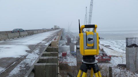
TOPOGRAPHIC SURVEY
Topographic Survey is a survey used to establish a horizontal and vertical location of the buildings, roads, driveways, utility lines, and land characteristics, such as ditch lines and hills. Most topographic surveys will also include a boundary line location. Engineers then use this information for future design.
ROUTE SURVEY
Route Survey is a topographic survey of a corridor to develop a transmission line, gas line, roads, or long, narrow project. Call for more information.
BUILDING STAKEOUT
Building Stake-out is used for houses close to the property or setback lines and substantial commercial buildings. Wood stakes are placed at the proposed building location so the contractor can accurately build the structure on the lot.
CONSTRUCTION STAKEOUT
Construction Stake-out is for curb and gutter construction, roads, parking lots, retention ponds, and drainage ways. Wood stakes are placed so the contractor can build in an accurate location.
UTILITY STAKEOUT
The Utility Stake-out survey is for the accurate construction of utility lines such as gas, water, electric, sewer, and fiber optic. Wood stakes are placed at the proposed line's location and offset points so the contractor can accurately build the utility in the designed location.
AS-BUILT SURVEY
An as-Built survey is a topographic survey of a project that has just been constructed. It is used to verify that the locations of structures are in the correct place. It is also used to update maps for the municipalities. Call us today!

